
Unified Geospatial Intelligence · 7 Modules, One Platform
Seven modules, One workspace
Every module writes to the same area of interest. Ingest once, then process, query, model and decide without a single manual file conversion.
Module legend
01 / 07
Why GeoThinkLab
One ecosystem, from data acquisition to actionable spatial policy
GeoThinkLab is an integrated geospatial analytics and urban intelligence platform engineered to eliminate tool fragmentation. By unifying data collection, spatial programming, workflow automation, artificial intelligence and decision support into a single ecosystem, teams can move effortlessly from data acquisition to actionable spatial policy.

Centralized Data Infrastructure
Continuous ingestion of satellite, climate, marine and local raster or vector files with FAIR metadata indexing.

AI-Powered Accessibility
Plain-language natural language spatial querying for complex NetCDF, raster and vector layers without GIS expertise.

Visual & Programmable Analytics
Visual drag-and-drop workflow builders combined with a multi-language studio: Python, SQL, DuckDB, Apache Sedona.

Urban Digital Twins & Resilience
Simulate 3D city environments, classify land cover, and model end-to-end disaster hazards and recovery governance.
TRUSTED BY






02The Platform · Seven Integrated Modules
Seven integrated modules. One ecosystem
Every module operates as an interconnected node. Datasets collected in GeoFairDataHub instantly feed every other module, with zero manual file transfers across the workflow pipeline.
Module directory
01 / 07
Data Infrastructure
The single source of truth for collecting, organizing, cataloging, and distributing geospatial datasets across the entire platform.
Module 01 / 07
GeoFairDataHub · Module Detail
Centralized Connectivity & Geospatial Data Hub
01
Multi-Source Ingestion
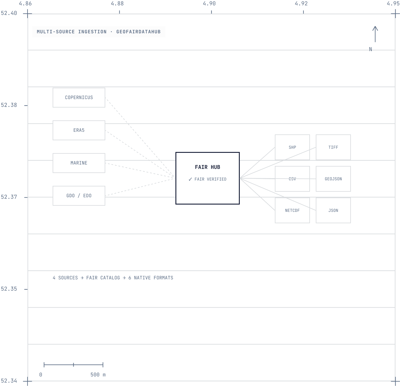
Direct API connectivity to Copernicus, ERA5 climate reanalysis, Copernicus Marine, Global & European Drought Observatories (GDO/EDO), and weather services.
02
Multi-Format Native Storage
Support for Shapefile, GeoJSON, Raster, TIFF, NetCDF, and CSV data formats.
03
FAIR Engine & Geo-Ontology
Built-in metadata tagging, dataset indexing, and automated data discovery compliant with FAIR principles.
04
Project Workspaces & Governance
Centralized database storage with project-level access control and organization.
Data Input
External climate/satellite APIs, weather streams, and uploaded CSV, SHP, GeoJSON, TIFF, and NetCDF files.
Output & Deliverables
Synchronized datasets directly accessible across all 6 analytical and development modules.
What our clients are saying
“GeoQuery let us ask questions in plain language and get an answer, instead of writing a script every time we needed to look at the data differently.”

A. Marchetti
Research Lead, AXIOM INSTITUTE


Who it is for
Researchers, urban planners and policy decision-makers
One workspace that carries a question from raw multi-source data through to a decision, without changing tools at every step.
01
Researchers
Run reproducible spatial analysis on FAIR-indexed datasets without rebuilding a toolchain for every study.
·
Copernicus, ERA5 and marine data ingested once
·
Python, DuckDB, Sedona and PySpark in one studio
·
Metadata tagging and project-level workspaces
02
Urban planners
Read the city as it is, then test what a change would do to it, on one 3D base map.
·
3D base maps of buildings, roads and terrain
·
NDVI, NDWI and land cover classification
·
Amenity proximity and shortest-path routing
03
Policy decision-makers
Turn hazard modeling into something a committee can act on: named risks, costed damage, a recommendation.
·
Composite multi-hazard risk indices
·
Economic loss and population impact estimates
·
Stakeholder analysis and policy recommendations
Processing Library
Functional blocks by category, GeoProcessing
100
Raster operations
80
Shapefile operations
55
NetCDF operations
50
Spatial statistics
30
OSM and NetworkX
20
File conversions
10
CRS and projections
Move from data acquisition to spatial policy in one platform
Ingest once. Query, model and decide across 7 integrated modules.
GEOTHINKLAB
An integrated geospatial analytics and urban intelligence platform engineered to eliminate tool fragmentation.
Platform
GeoFairDataHub
GeoProcessing
GeoQuery
GeoVision
GeoTools
GeoCode
GeoResilience
Solutions
Urban resilience
Climate adaptation
Flood risk
Land cover
Research teams
Resources
Documentation
API reference
Data sources
Case studies
Changelog
Company
About
Technovative Solutions
Careers
Contact
Legal